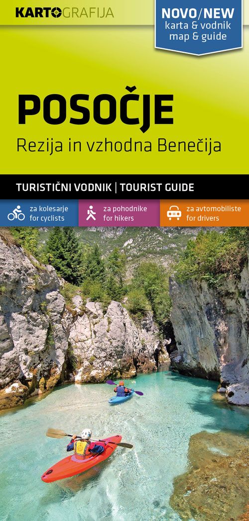
Wander- & MTB-Karte Posočje/Sočatal 1:40.000
Original price was: €14,90.€4,47Current price is: €4,47.
Description
Posočje tourist map is a double-sided maps in scale of 1:40.000 accompanied by bilingual guide (Slovenian and English) with descriptions of hiking trails, cycling routes, places of interest, lists of mountain huts, etc. Hiking paths and cycling routes are shown on the map and cross-referenced to their descriptions in the guide. A wide range of symbols provide information on various types of accommodation (rural hotels, motels, farms, mountain huts, campsites), recreational facilities, picturesque locations, locations of petrol stations. Descriptions of hiking routes give timings and the degree of difficulty, as do notes for cycling routes which are also accompanied by route profiles. Map legends and all the text include English.
| Gewicht: | 84 g |
|---|---|
| Verlag: | Kartografija Slovenija |
| Reihe: | Kartografija 1:40.000 |
| Maßstab: | 1:40.000 |
| Medienart: | Karten |
| Sprache: | Englisch, Slowenisch |
| EAN: | 3830048522540 |
| Erscheinungsjahr: | 2020 |
| Kontinent: | Europa |
| Land: | Slowenien, Italien |
| Bundesland / Provinz: | Friaul-Julisch Venetien |
| Region: | Julische Alpen, socatal, Brda, Collio, Julische Voralpen |
| Orte / Berge / Seen: | Bovec, Trenta, Krn, Kanin, Montasch, Kobarid, Tolmin, Sella Nevea, Matajur, Passo del Predil, Görz, Gradisca, Dobrovo, Resiatal, Kanal, Žaga, Breginj, Deskle |

Reviews
There are no reviews yet.